Winter Weather Advisory for NW NJ Sunday: From ice to rain to bitter cold
Ice
Sunday's forecast is all about air temperature. While Sunday is starting off cold across most of New Jersey (20s and lower 30s), temps will slowly rise above freezing. So the threat of wintry weather we're discussing will be limited to the morning hours. And it will be strictly limited by geography as well — not everyone in NJ has to necessarily watch their step Sunday.
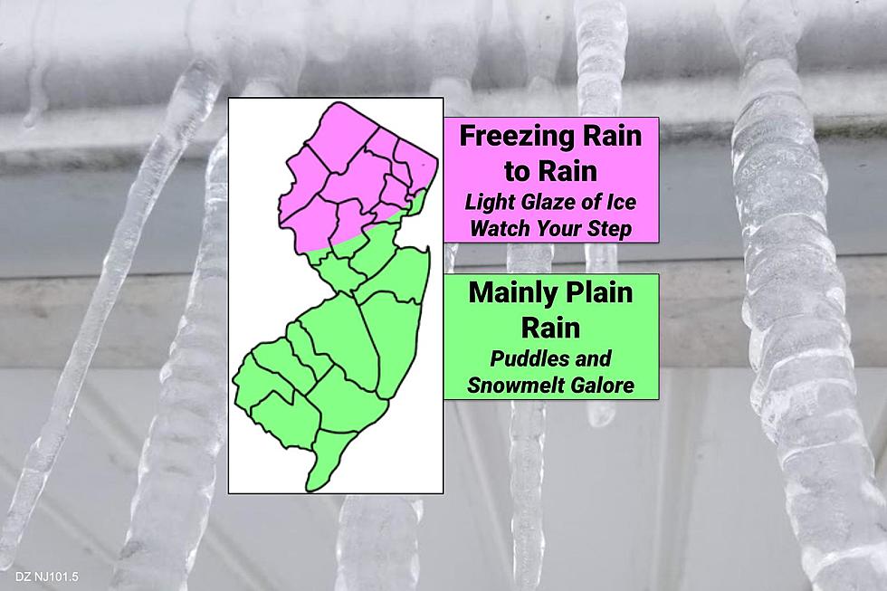
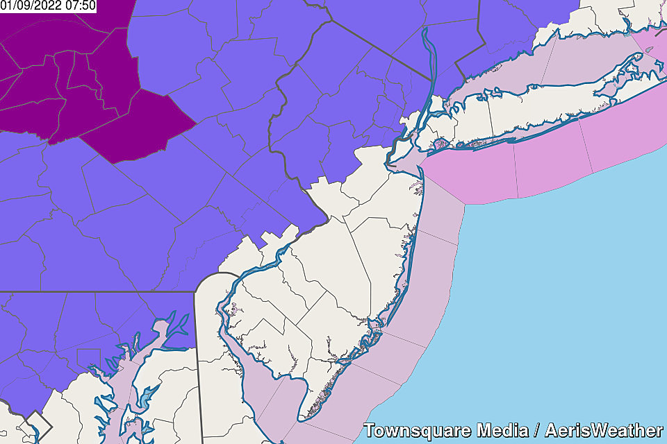
In fact, the latest model guidance suggests the most hazardous icing concern has retreated into northwestern New Jersey, drifting away from the NJ Turnpike corridor. The National Weather Service concurs, scaling back the Winter Weather Advisory to now include 9 NJ counties. (Mercer and Middlesex are out.)
As of this writing (7:30 a.m.), the day's first band of precipitation is just now sneaking into NW NJ. Temperatures are in the 20s, so it will start as wintry mix.
The worst-case (and most likely) scenario here is a few hours of freezing rain. As we talk about endlessly, it doesn't take much freezing rain at all to turn untreated surfaces into a skating rink. And it will be "black ice" — a sidewalk or roadway may look wet, but it is actually frozen over.
I am most concerned about the area north of Interstate 78 and west of Interstate 287 — the coldest corner of the state.
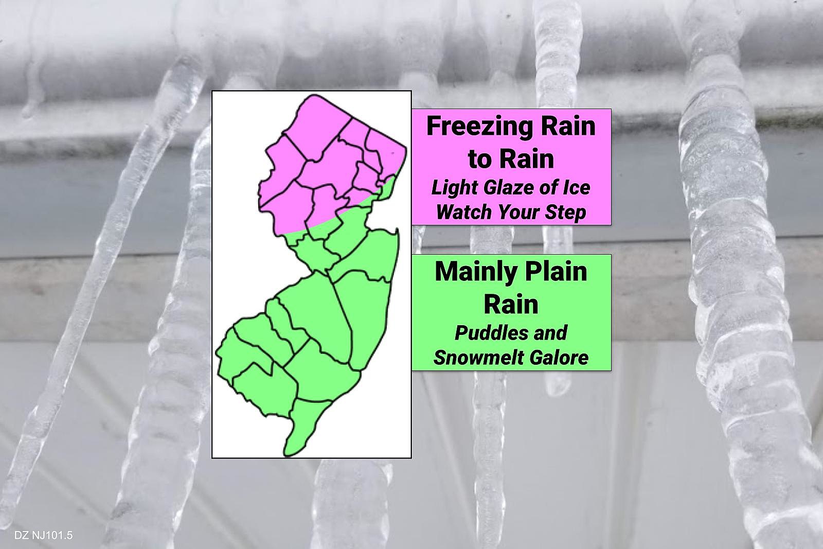
By about Noon or 1 p.m., temperatures will rise above freezing, and any precipitation will turn to just plain rain.
So it is a minor winter weather event, especially given the limited geography, short time window, and minor impacts. No snow accumulation, just the threat of light icing. I think common sense goes a long way in a situation like this — don't travel Sunday morning unless you have to, and pay careful attention to changing weather and road conditions.

Rain
For central, southern, and coastal New Jersey, it's going to be a damp (not icy) day. And to the north, we'll transition from icy mix to rain soon enough.
Rain is not expected to be heavy, but it may impact any outdoor plans. Rainfall totals will probably end up between a tenth of an inch and a quarter-inch. With high temperatures in the 40s, we should see a great deal of snowmelt on Sunday too.
Final raindrops will come Sunday evening, as the arrival of cooler, drier air sweeps out the wet weather.
Bitter Cold
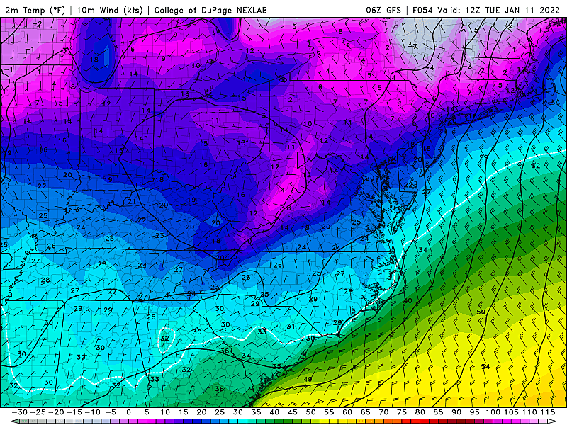
The 5 Day Forecast adequately tells the story of the frigid weather that settles in this week.
Monday's highs barely to the freezing mark. Tuesday in the lower to mid 20s, with potentially dangerous around 0°. We'll get a brief warmup into the 30s on Wednesday and 40s on Thursday. But don't expect that to last as another push of arctic air is likely to arrive next weekend.
Of course, bitterly cold weather is also (usually) quiet weather. The insurgence of cold air negates any chance of a winter storm for most of this week. It will be nice to catch our breath after such a busy start to the year.
Having said that, we will have to carefully watch what develops next weekend. Depending upon which run of which model you believe, there will be a threat of significant winter weather in New Jersey in the Friday-Saturday-Sunday time frame.
Dan Zarrow is Chief Meteorologist for Townsquare Media New Jersey. Follow him on Facebook or Twitter for the latest forecast and realtime weather updates.
The Blizzard of '96 Revisited: Snow totals for every NJ county
Gallery Credit: Joe Votruba
New Jersey at different points in world history
More From 92.7 WOBM


