
Stormy evening: Severe T-Storm Watch for all of NJ until 10 p.m.
The Watch
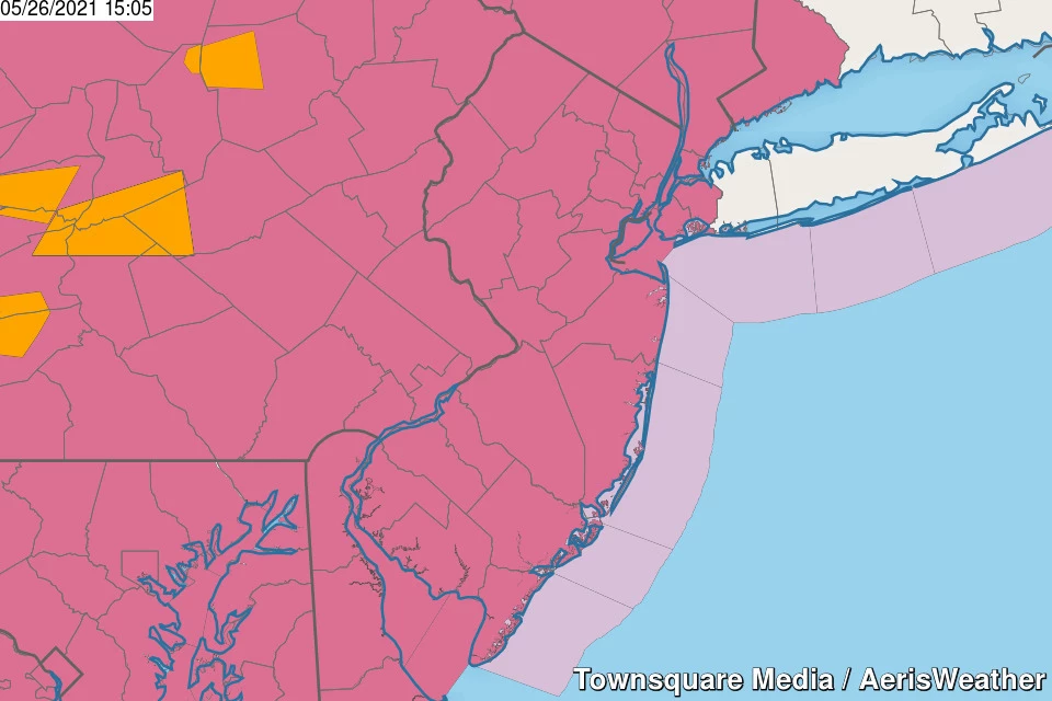
The National Weather Service, in conjunction with the Storm Prediction Center, has issued a Severe T-Storm Watch for all 21 counties of New Jersey, in effect through 10 p.m. Wednesday evening.

A “watch” is a formal heads up that dangerous thunderstorms are likely. You should be aware that the threat exists, and carefully consider any outdoor and travel plans. Be prepared to seek shelter in a sturdy building if warnings are issued.
Threats from thunderstorms that develop Wednesday evening include damaging 60+ mph wind gusts, small hail, and even an isolated tornado. Although outside the traditional definition of “severe weather,” flooding rains and frequent lightning are likely too.
When?
So far, Wednesday has been a hot, humid, summerlike day. It certainly feels like a storm could explode at any time.
As of this writing (3 p.m.), the first thunderstorm activity is about 60 miles west of the Garden State.
It looks like thunderstorms will sweep from west to east across NJ in approximately two waves. The first between about 5 p.m. and 11 p.m., and the second from 8 p.m. to 2 a.m. (Yes, there is quite a bit of overlap there.)
Sunset will be an important benchmark here. Once the sun goes down and temperatures start to cool, temperatures will lose part (not all) of their energy source. Therefore, any storms that form before 8:15 p.m. are most likely to be strong or severe, before things pulse down and calm down later on.
Where?
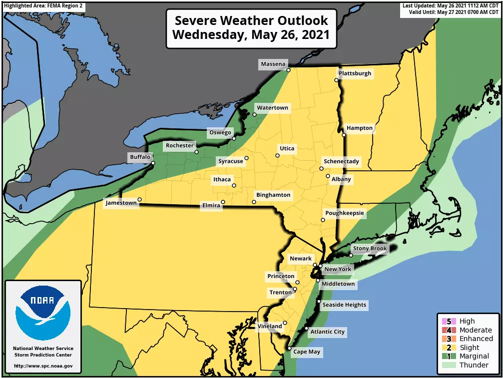
As evidenced by the watch’s geography, covering all 21 counties, thunderstorms are expected to be pretty widespread. Storm cells (especially the initial ones) are expected to be scattered, or spread apart - that means not everyone in NJ will necessarily see a storm. Still, I have no reason to believe that any corner of the state is “safe” from stormy weather Wednesday evening.
The farther west you are, the better your chance of severe wind and drenching rain. That is due to timing - the western half of the state is more likely to experience storms before sunset. And also because the air closer to the coast is slightly cooler and more stable, so storms should weaken a little bit as they charge east.
So What?
Bottom line: It’s going to be a stormy night across New Jersey. You need to remain “weather aware,” staying extra alert to changing weather conditions. The safest place to be during any thunderstorm is inside a sturdy building.
The wind and tornado threats are most serious. Worst case scenario, downed trees can cause power outages, property damage, and travel difficulties.
Lightning is, by definition, part of every thunderstorm. It could contribute to power outages, if lines or transformers are struck. Lightning strikes can also cause fires - remember, our brush is very dry right now.
Finally, heavy rain may cause brief instances of flash flooding. Luckily, the ground is very dry (or “thirsty), given our recent rainfall deficit. But there could still be significant ponding issues in low-lying areas and/or along roadways. Especially if storm drains become blocked. Think “big puddles”. Nothing biblical. But still, it’s never smart to drive, walk, or swim through flooded areas.
What’s Next?
Any residual showers will wrap up by daybreak Thursday. As humidity levels will steadily dial back throughout the day, it should be a gorgeous day with sunshine and 80 degree temperatures.
Things go downhill again on Friday, with clouds, cooler temperatures, and eventually some soaking rain. The Memorial Day Weekend will start with raindrops, but it won’t be a washout. Please read my Wednesday morning weather blog update for more details on the holiday weekend forecast.
As always, please be smart and stay safe out there.
Dan Zarrow is Chief Meteorologist for Townsquare Media New Jersey. Follow him on Facebook or Twitter for the latest forecast and realtime weather updates.
CHECK OUT: Where NJ's biggest winning lottery tickets were sold
More From 92.7 WOBM


