
NJ’s first weekend of fall: Some sun, mild temps, one rain chance
On the whole, this weekend's forecast looks pretty good. A little bit of "perfectly pleasant" sunshine and mild temps. Some warmth and humidity. And one little rain chance, which hopefully won't get in the way of your weekend plans.
We're starting off this Friday morning with areas of low-level ground fog. Visibility has been as low as a quarter-mile in spots, so you may have to slow down a bit on your early commute. I do not expect this fog to last long — visibility should improve dramatically by about 9 a.m.
Friday's temperatures are starting off mainly in the 50s, with a little chill in the air. We'll see high temperatures in the mid 70s Friday afternoon — cooler than Thursday and slightly above-normal for late September.
Skies will be mostly sunny for most of the day, although clouds will start to build around late afternoon. That will lead to a mostly cloudy Friday night. We'll remain dry and comfortably cool though, with lows dipping into the upper 50s to around 60 degrees by Saturday morning.
I have to be honest, Saturday looks a bit iffy. At least more than it has looked all week. Mixed clouds and sunshine will meet warmth and humidity, with high temperatures popping to around the 80-degree mark. Model guidance is showing a chance for sprinkles Saturday morning. But the bigger rain chance (by far) will hold off until Saturday night. A round of thunderstorms is likely, for northern and central NJ at least. That rain will probably fizzle quite a bit before reaching South Jersey.
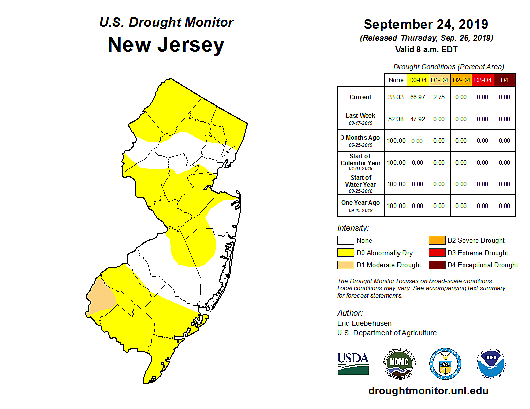
And that's unfortunate, as we could really use some solid rain. The latest U.S. Drought Monitor now shows about two-thirds of New Jersey falls into the D0 - Abnormally Dry category. Much of Salem County in southwestern NJ is now officially classified as D1 - Moderate Drought.
By the time you wake up Sunday morning, we'll be drying out and cooling down. It should make for a nice end to the weekend, with mostly sunny skies, a fresh breeze, and highs returning to the mid 70s.
Thanks to an on-shore breeze, Monday looks even cooler. Highs will be limited to the lower 70s, with part of the Jersey Shore potentially stuck in the upper 60s. At least we'll enjoy another mostly sunny and dry day.
Next week's weather is really going to be a wild ride — so hold on tight!
We flip from sea breeze to land breeze on Tuesday, kickstarting another warmup to around 80 degrees. Wednesday gets even warmer — dare I say, hotter — with mid to upper 80s possible. (I mean, the Euro is really pumping out some late-season 90s!)
Our next storm system arrives on Thursday with a substantial cooldown and the chance for steady rain. Wet weather may persist into Friday. Things settled down for the first weekend of October, as seasonable high temperatures near 70 degrees take over.
Have a great weekend!
Dan Zarrow is Chief Meteorologist for Townsquare Media New Jersey. Follow him on Facebook or Twitter for the latest forecast and realtime weather updates.
More From 92.7 WOBM


