NJ will get soaked Friday and this weekend, but no total washouts
Well Thursday turned into a lovely fall day! Sunshine and seasonable temperatures - you can't ask for more than that, especially given our cool weather trend lately. Thermometers are about to take a dip again, and we have two batches of rain to discuss over the next three days. Umbrellas up and wipers on!
It's actually not that cold for Friday morning, as temps have only dropped into the 40s overnight. That is thanks to a blanket of clouds and a little breeze, keeping the air stirred up.
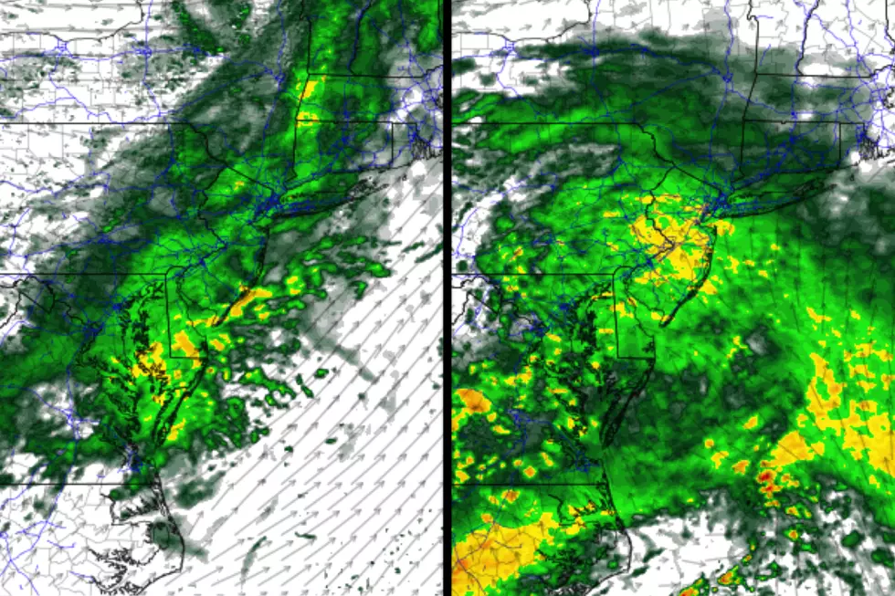
To start, Friday will be mostly cloudy with highs in the mid to upper 50s. It's going to get somewhat windy, as gusts peak in the 25 to 35 mph range. In addition, we're going to get wet as a cold front approaches New Jersey.
Most likely window for rain in the Garden State will be from Friday midday through late afternoon. Let's say 11 a.m. to 5 p.m. Rainfall intensity will be light to moderate. Rainfall totals will range from a tenth to a quarter of an inch.
Skies will quickly clear out Friday evening. It's going to be cold, and it will remain breezy — not a good combination. Overnight low temperatures will dip into the upper 20s to lower 30s — a freeze for the vast majority of the state, I think. The wind chill ("feels like" or "apparent" temperature) will dip easily into the teens with that biting breeze.
Honestly, most of Saturday looks fine. You'll see lots of sunshine throughout the day. And it will definitely be cool, with highs in the mid 40s.
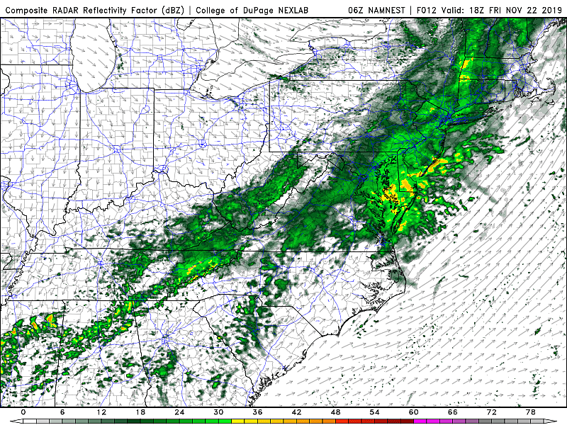
Our next storm system will hold off until Saturday night, and this one has the potential to be a real soaker.
Best chance for rain will be from about 9 p.m. Saturday through at least Sunday morning. Rainfall intensity will be moderate to heavy at times, with the biggest downpours during the overnight hours. Rainfall totals will probably end up around 3/4-inch.
There is still a risk for a bit of wintry mix along the way, but only in far northwestern New Jersey — Sussex, Warren, and Passaic counties. Models are pumping out the potential for a glaze of ice and/or a light coating of snow. I suppose it's possible, but I'm not overly concerned about wintry impacts, as road surfaces will be relatively wet and warm.
So Sunday will generally start rainy and breezy. I'm optimistic we'll dry out and see some late clearing Sunday afternoon. Because of the newly-extended rainfall forecast, I've had to decrease temperature expectations a bit. Look for highs in the upper 40s or so.
Early next week is looking reasonably pleasant. Partly sunny and lower 50s on Monday. Mostly sunny and mid 50s on Tuesday.
And then along comes the big Thanksgiving travel season. I have two (minor) concerns:
1.) A cold front passing through New Jersey Wednesday morning will produce a brief period of rain. As I've discussed previously, models are not showing an area of stronger low-pressure tracking along that front. So I'm still leaning on a light, rain-only forecast.
2.) Behind the front, winds are going to get gusty, perhaps as high as 40 or 50 mph. That raises alarm bells for the Macy's Thanksgiving Day Parade in New York City, as winds will be elevated during both the Wednesday evening balloon inflation and possibly the parade itself Thursday morning. I'm sure parade officials are sweating this new forecast development. We'll just sit tight and hope for the best. (My sons are really hoping to see Snoopy and Chase and Olaf on TV!)
Have a great weekend. Stay dry!
Dan Zarrow is Chief Meteorologist for Townsquare Media New Jersey. Follow him on Facebook or Twitter for the latest forecast and realtime weather updates.
More From 92.7 WOBM


