
More hit or miss storms Wednesday – big pattern change is coming
It rained. It poured. (The old man snored, haha.) Top rainfall totals on Tuesday topped 2 inches, as strong thunderstorms dumped heavy rain over a large swath of central New Jersey. Some small hail was reported over Monmouth County too.
We're still stuck in this stormy, unsettled weather pattern. However, the stalled frontal boundary slips southward today. That shift means 1.) showers and thunderstorms will become more hit-or-miss, 2.) we fall out of the bullseye for severe weather, and 3.) temperatures will trend slightly cooler.
So, widely scattered showers and thunderstorms are expected to produce occasional downpours throughout the day Wednesday. Because the ground is already thoroughly soaked, it won't take much heavy rain to produce ponding and flooding. Therefore, the National Weather Service refreshed our Flash Flood Watch, in effect from Noon Wednesday through 6 a.m. Thursday for all or part of 12 New Jersey counties: northwestern Burlington, Camden, Gloucester, Hunterdon, Mercer, Middlesex, Monmouth, Morris, Salem, Somerset, Sussex, and Warren.
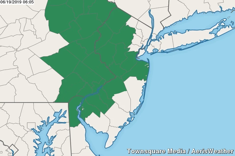
In between raindrops, the day will be mostly cloudy and very humid. My forecast calls for high temperatures between about 75 and 80 degrees.
We'll keep the chance of scattered rain alive for most of Wednesday night too. Fog is likely. Mugginess is a definite. Lows only fall into the upper 60s.
Thursday actually promises to start off dry. Hey, most of the day could be dry. And you might even catch a few peeks of sunshine. That will, of course, warm us up again — highs pop into the lower to mid 80s. And warmer temperatures and a more unstable atmosphere will put severe weather back on the table.
One final round of strong to severe thunderstorms looks probable starting Thursday afternoon. Given the heat and humidity, the strength of our approaching cold front, and our recent history of significant local storms, we'll have to put the full gamut of severe weather impacts in the forecast — torrential downpours, damaging winds, hail, and an isolated tornado. Timing will play a huge role in the development of these "grand finale" storms — if they don't fire until almost sunset (a distinct possibility), the storm intensity will be limited.
Rain showers are expected to exit New Jersey Friday morning, by about 10 a.m. at the very latest. Then skies will clear to sunshine with a stiff northwesterly breeze through Friday afternoon. As our atmosphere dries out, humidity levels will drop precipitously, and it will get much more comfortable. With high temperatures in the upper 70s to around 80 degrees, our weather should improve dramatically for the First Day of Summer. (The Summer Solstice officially occurs at 11:54 a.m. Friday.)
I'm still optimistic that this big pattern change will set us up for a great first weekend of summer! Mostly sunny, breezy, and dry on Saturday, with highs in the lower 80s. Partly sunny, still dry, and warmer Sunday, with highs in the mid 80s.
The long-term forecast includes a few diurnal ("heat of the day") showers and thunderstorms on Monday and Tuesday. Models are also pointing to a big warmup, with thermometers surging into the upper 80s to lower 90s. Could next week deliver New Jersey's first heat wave of 2019?
Dan Zarrow is Chief Meteorologist for Townsquare Media New Jersey. Follow him on Facebook or Twitter for the latest forecast and realtime weather updates.
More From 92.7 WOBM


