Friday NJ weather: Nice for now, but Delta’s remnants will be weekend weathermaker
The Bottom Line
The weekend will start off pleasant and dry, with a warming trend. But the remnants of Hurricane Delta will increase humidity and cloud cover, eventually leading to soaking rain by the end of the weekend.

Friday
We're definitely back to "jacket weather" Friday morning, with a definite chill in the air. Away from the immediate coast, we're averaging 40 degrees to start the day. Thermometers are holding closer to 50 along the Jersey Shore. But, not to worry! Plentiful sunshine and very dry air mean we'll warm up quickly, as temps push into the upper 60s to around 70 degrees for Friday afternoon. Overall, a fantastic fall day.
Friday night won't be as cold as Thursday night, as low temperatures only dip into the mid 50s. Clouds will increase overnight.
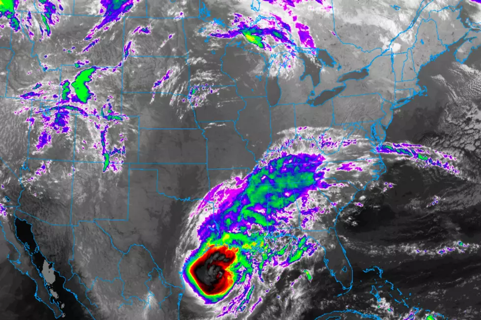
Hurricane Delta will make landfall along the Louisiana coast Friday evening. 6+ inches of rain, 100+ mph winds, and up to 12 feet of storm surge. A bad, bad scene there.
Saturday
For the northern third to half of the Garden State, we should get good sunshine for most of Saturday. Farther south, clouds will win the day. A few models even show some sprinkles passing through southern New Jersey in the early morning hours. But it's hard to believe raindrops will extend that far from the center of Delta's remnants, so I've opted for a dry forecast.
Saturday will turn a bit more humid. And noticeably warmer too. Most high temperatures will soar into the mid to upper 70s. A few 80s are a possibility!
Sunday
Skies will turn mostly cloudy to overcast for everyone. The first half of the day actually looks fine, as we hold on to high temperatures in the 70s. However, first raindrops will likely creep into New Jersey between 2 p.m. and 6 p.m. Just showers to start, but things will turn wetter and nastier Sunday night into Monday.
Monday
Could be a total washout. We're going to get soaked just about all day Monday, with bands of steady to heavy rain streaking through New Jersey. The heaviest rain is expected Monday morning.
If you read my weather blog frequently, you know my mantra: Never underestimate tropical moisture. I think 1 to 2 inches of total rainfall is a good bet statewide. Wet, wet, wet.
Some models continue to paint more dramatic, more impactful rainfall totals in the 2 to 4 inch range — that's not outside the realm of possibilities here. While our weather has been dry lately (and therefore the ground is "thirsty"), any prolonged downpours may result in ponding or flooding issues.
It'll be breezy too, but I don't expect wind gusts much beyond 20 mph. High temperatures on Monday will drop to the lower-mid 60s, thanks to the rainy, yucky conditions.
Tuesday & Beyond
Although Tuesday won't be as soaking wet as Monday, a chance of showers will continue as residual tropical moisture interacts with an approaching cold front. There's reason for hope that we'll salvage pieces of the day. And a good chance temperatures recover into the 70s.
The effects of that cold front, followed by a secondary frontal passage on Wednesday will clearing out the skies and dry out our air. As sunshine emerges on Wednesday, we should still reach the 70s. But temps will probably return to the 60s for Thursday and beyond, as a more seasonable air mass moves in to the neighborhood.
Dan Zarrow is Chief Meteorologist for Townsquare Media New Jersey. Follow him on Facebook or Twitter for the latest forecast and realtime weather updates.
More From 92.7 WOBM


