A foot of snow, an inch of rain: Recap of NJ’s weekend nor’easter
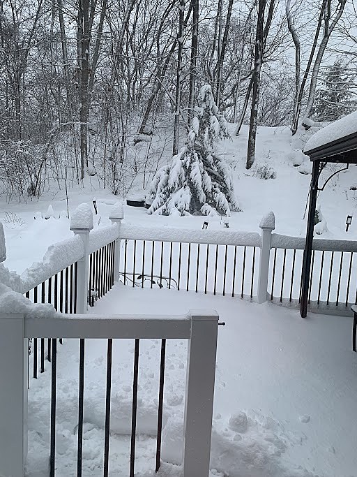
The first weekend of 2024 arrives with a splash and a thud, as Mother Nature pushed a powerful coastal storm through New Jersey. As you probably know, this nor'easter caused a variety of weather impacts from one end of the Garden State to the other — from snow to ice to slush to rain to wind to coastal flooding.
The storm calmed down late Saturday night, and the forecast calls for lingering snow and rain showers ending early Sunday afternoon. Up to an inch of additional snow accumulation is possible, but only in the "snow zone" of North Jersey.
It is also worth mentioning there is another big storm aiming for New Jersey in the Tuesday-Wednesday time frame. Keep an eye on Dan Zarrow's Weather Blog for more details on that heavy rain and wind machine.

Let's do a quick by-the-numbers, county-by-county, post-mortem summary of this weekend's nor'easter. Top rain totals, snow totals, wind gusts, and maximum temperatures across New Jersey. I also include an estimate of my final snowfall forecast for reference, which fared pretty well overall.
A few important notes about this data analysis:
1.) Total snowfall is recorded at its maximum, before melting and/or rain cause it to melt or wash away.
2.) The "Rain" number listed represents either total rainfall, snow liquid equivalent, or both combined.
3.) All data is accurate as of 9 a.m. Sunday, and will be updated after the storm exits, if needed.
4.) Data is unofficial and unverified. My goal is to paint a picture of how the storm played out - not review every weather observation from across the state.
5.) Data comes from the National Weather Service, NJ Weather & Climate Network, and CoCoRaHS.
Statewide Winners
—Snow... The biggest snow total I could find so far is 13.0" at Wantage, Sussex County. Over a foot of snow! There was an additional 12.6" snowfall report near Wantage too, giving credence to that impressive top total. Of course, at the opposite end of the state, five NJ counties reported exactly zero snowfall: Atlantic, Cape May, Cumberland, Ocean, and Salem.
—Rain (or Snow Liquid Equivalent)... Rainfall totals over southern New Jersey exceeded an inch in most places. Top total was 1.62" at Berkeley Township, Ocean County. North Jersey was colder and snowier, and therefore drier. It is notable though that all NJ counties picked up at least 0.75" of rain or melted snow.
—Wind... The wind really howled Saturday night, especially along the Jersey Shore. Top gust in the state was 53 mph at Little Egg Harbor Township, Ocean County. Almost every county in the state — aside from Mercer, Passaic, and Warren — reported at least one wind gust over 25 mph.
—Max Temperature... The temperature range during the height of the storm was pretty incredible. While Sussex County was stuck in the 20s (no warmer than 32 degrees at Walpack), Woodbine in Cape May County hit 50 degrees.
Atlantic County
Snow... 0 (Forecast: 0)
Rain... 1.30" at Absecon
Wind... 50 mph at Atlantic City Marina
Max Temp... 49° at Atlantic City Marina
Bergen County
Snow... 5.7" at Franklin Lakes (Forecast: 2-5" East, 5-10" West)
Rain... 0.94" at Oakland
Wind... 28 mph at Lyndhurst
Max Temp... 37° at Lyndhurst
Burlington County
Snow... 0.1" at Burlington, Mt Laurel, and Westampton (Forecast: 0-Coating)
Rain... 1.13" at Moorestown
Wind... 37 mph at Silas Little (Pemberton)
Max Temp... 46° at Silas Little (Pemberton)
Camden County
Snow... 0.1" at Barrington (Forecast: 0-Coating)
Rain... 1.30" at Sicklerville
Wind... 28 mph at Pennsauken
Max Temp... 46° at Sicklerville
Cape May County
Snow... 0 (Forecast: 0)
Rain... 1.47" at Wildwood Crest
Wind... 38 mph at Woodbine
Max Temp... 50° at Woodbine
Cumberland County
Snow... 0 (Forecast: 0)
Rain... 1.13" at Fortescue
Wind... 33 mph at Fortescue
Max Temp... 49° at Fortescue
Essex County
Snow... 4.4" at North Caldwell (Forecast: 2-5")
Rain... 0.82" at Montclair
Wind... 28 mph at Caldwell
Max Temp... 36° at Caldwell
Gloucester County
Snow... Trace at Franklin, Paulsboro, and Pitman (Forecast: 0-Coating)
Rain... 1.15" at Mantua
Wind... 26 mph at Logan
Max Temp... 47° at Piney Hollow (Franklin)
Hudson County
Snow... 1.0" at Harrison (Forecast: 2-5")
Rain... 0.90" at Jersey City
Wind... 29 mph at Jersey City
Max Temp... 38° at Jersey City
Hunterdon County
Snow... 5.0" at Bethlehem (Forecast: 2-5")
Rain... 0.94" at Flemington
Wind... 34 mph at Pittstown
Max Temp... 34° at Kingwood
Mercer County
Snow... 2.0" at Woodsville (Forecast: Coating-2")
Rain... 1.02" at Princeton
Wind... 23 mph at Hopewell
Max Temp... 42° at Hamilton
Middlesex County
Snow... 2.0" at Metuchen and North Brunswick (Forecast: Coating-2")
Rain... 1.06" at East Brunswick and New Brunswick
Wind... 31 mph at East Brunswick
Max Temp... 37° at East Brunswick and New Brunswick
Monmouth County
Snow... Trace at Howell and Upper Freehold (Forecast: 0 Coast, Coating-2" West)
Rain... 1.42" at Sea Girt
Wind... 46 mph at Sea Girt
Max Temp... 47° at Sea Girt
Morris County
Snow... 8.1" at Green Pond (Forecast: 5-10")
Rain... 1.23" at Jefferson
Wind... 24 mph at Morristown
Max Temp... 33° at Parsippany
Ocean County
Snow... 0 (Forecast: 0-Coating)
Rain... 1.62" at Berkeley
Wind... 53 mph at Little Egg Harbor
Max Temp... 48° at Harvey Cedars
Passaic County
Snow... 5.0" at Totowa (Forecast: 5-10")
Rain... 0.94" at Little Falls
Wind... 17 mph at Charlotteburg
Max Temp... 35° at North Haledon
Salem County
Snow... 0 (Forecast: 0-Coating)
Rain... 1.14" at Lower Alloways Creek
Wind... 36 mph at Lower Alloways Creek
Max Temp... 45° at Mannington
Somerset County
Snow... 5.0" at Far Hills (Forecast: 2-5")
Rain... 0.79" at Bernardsville
Wind... 28 mph at Hillsborough
Max Temp... 35° at Hillsborough
Sussex County
Snow... 13.0" at Wantage (Forecast: 5-10")
Rain... 1.37" at Vernon
Wind... 33 mph at High Point
Max Temp... 32° at Walpack
Union County
Snow... 2.5" at New Providence (Forecast: 2-5")
Rain... 0.99" at Cranford
Wind... 29 mph at Newark Airport (Elizabeth)
Max Temp... 39° at Newark Airport (Elizabeth)
Warren County
Snow... 10.5" at Blairstown (Forecast: 5-10")
Rain... 1.30" at Washington
Wind... 20 mph at Pequest
Max Temp... 34° at Pequest
Dan Zarrow is Chief Meteorologist for Townsquare Media New Jersey. Check out Dan's weather blog or follow him on Facebook for your latest weather forecast updates.
Dan Zarrow's Top 10 Weather and Climate Stories of 2023
Gallery Credit: Dan Zarrow
Let it snow: 12 things to know about winter forecasting in NJ
Gallery Credit: Dan Zarrow
More From 92.7 WOBM