
Tuesday NJ weather: Same hot temps, more humid, late-day storms
The Bottom Line
Steamy and stormy, blah blah blah. This is the grand finale of our latest wave of extreme heat. A cold front will spark thunderstorms, following by a return to more seasonable, more seasonable summer weather. But don't expect much of a cooldown — temps may still hit 90 degrees somewhere in New Jersey every single day this week.
Tuesday
Take Monday's high temperatures, copy and paste into Tuesday's forecast, and add an extra dash of atmosphere moisture. The result is another ferociously hot and humid day, both uncomfortable and potentially dangerous.
We're starting off with what will absolutely be one of the warmest mornings of the year. Temperatures have not fallen below 80 degrees in cities and along the coast — yuck! High temps are forecast to hit the lower to mid 90s. The heat index ("feels like" or "apparent" temperature) will push into the danger zone of 100 to 105.
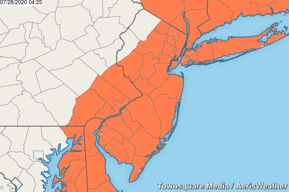
This goes beyond "normal" summertime heat. You have to consciously take care of yourself (and pets and kids and elderly) — dress for the weather, take frequent breaks from the heat, and stay extra hydrated. A Heat Advisory is in effect for almost all of New Jersey until 8 p.m. (The only exceptions: Sussex and Warren counties.)
You'll see morning sunshine, before clouds roll in. There will be a westerly breeze at 10 to 15 mph — not as strong as Monday. So the land breeze might be light enough to allow a little sea breeze to set up along the Jersey Shore, keeping temperatures slightly cooler. Key word: slightly.
The other big weather story Tuesday will be some big thunderstorms, sparked by a cold front arriving from the west. It looks like the storm risk will come in two parts. First, in northern NJ (above the Interstate 287 corridor), a few spot storms will probably popup in the afternoon hours. Farther south, scattered showers and thunderstorms should hold off until dinnertime or later Tuesday evening.
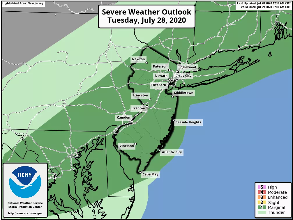
Not everyone will get wet here. But given the heat and humidity (a.k.a. energy and moisture), any storm that forms could produce heavy rainfall (1+ inch) and/or gusty winds (60+ mph).
Any showers and thunderstorms will exit New Jersey late Tuesday night, with clearing skies after Midnight.
Wednesday
You will feel the effects of that cold front on Wednesday, especially since dew points will scale back to the 60s. However, don't expect much of a cooldown — high temperatures Wednesday afternoon will still shoot for about 90 degrees. Even so, I think it's fair to call it more reasonable, more seasonable summertime weather. (Keep in mind, our normal high temperature through early August is holding steady at 86 degrees.)
Wednesday should be a bright, sunny day. Guidance does show an isolated shower clipping far northern New Jersey at night.
Thursday
Things start to get a bit hazy in the Thursday-Friday time frame, as an area of low pressure passes south of New Jersey. The exact track and timing of that storm system shifts with every model run, so this is not an extraordinarily confident forecast.
At the moment, I'll put increasing clouds over the Garden State on Thursday, with a high again near 90 and a late-day chance of rain. The NAM and Euro models show an afternoon arrival time, while I favor the GFS solution showing raindrops starting Thursday evening. In any case, there's not much "oomph" behind the system, so we're just facing a period of "plain rain" through Thursday night.
Friday
While Friday had been looking potentially wet and dreary, the latest forecast puts rain only in the morning time frame. Sunshine and upper 80s would make for a very nice Friday afternoon.
Saturday
Looking good! Mostly sunny skies, manageable humidity, and highs around 90 degrees. Can't ask for much more for the first day of August!
Sunday
About the same as Saturday, but with extra clouds. In addition, models are hinting at a PM rain chance.
The Extended Forecast
The first full week of August looks warm and unsettled. 80s, clouds, and thunderstorms are in Monday's forecast.
Additionally, we're keeping a close eye on the tropics. There is a tropical wave charging toward the eastern Caribbean. Technically named "Invest 92L" as of this writing, it will probably develop into a tropical depression or tropical storm in the next 24 to 36 hours. The next name on the list is Isaias. (Pronounced with 4 syllables, ees-ah-EE-ahs.)
The consensus track has the storm clipping the islands along the northern edge of the Caribbean Sea (the Virgin Islands, Puerto Rico, and Hispaniola) before curving north toward the Bahamas and Florida. When and where that big turn happens will dictate whether the storm will impact the U.S. East Coast. If soon-to-be-Isaias does impact New Jersey's waves and weather, it would be in the 7 to 8 day time frame (Tue 8/4-Wed 8/5).
And again I have to stress that is a big if. Given the high uncertainty and multitude of possible tracks, I am not going to share any forecast graphics for this storm just yet.
Dan Zarrow is Chief Meteorologist for Townsquare Media New Jersey. Follow him on Facebook or Twitter for the latest forecast and realtime weather updates.
More From 92.7 WOBM

