NJ weather: Unsettled Wednesday, windy then stormy Thursday
Hey, we had one whole day of beautiful sunshine, mild temperatures, and dry weather on Tuesday! Unfortunately, we have already started to slip downhill again, as clouds, a stiff breeze, and cooler temperatures resume Wednesday.
As of this writing (5:30 a.m.) Wednesday morning, a warm front lifting through New Jersey has sparked a few spotty showers and sprinkles. The name warm front may be a little misleading here, because we won't really get to taste the warming effects of the new air mass. Skies will be mostly cloudy to overcast through Wednesday afternoon, limiting high temperatures to the 50s. There will be some 60s sprinkled in, to the south and west. That is about 5 to 10 degrees cooler than Wednesday, and about 5 to 10 degrees cooler than seasonal normals.
Another batch of showers and sprinkles is forecast later on (likely late afternoon through early evening). And then we're in a holding pattern for Wednesday night, with clouds and an increasing breeze. Low temperatures will end up only a few degrees cooler than our highs, in the lower 50s.
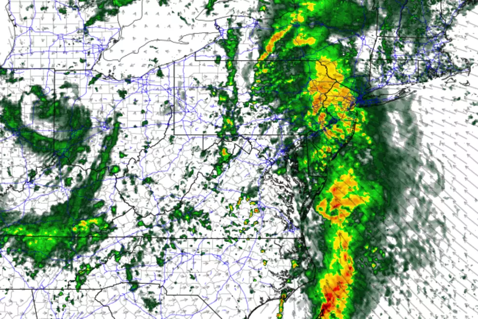
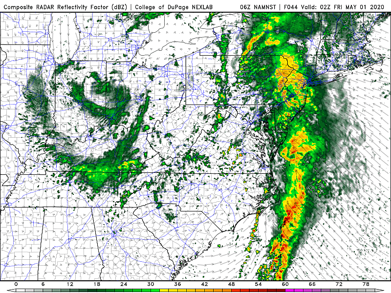
A powerful storm system will cause a severe weather outbreak in the Deep South (Alabama to Georgia) Wednesday, before turning toward the Northeast for Thursday. Our forecast has evolved a little bit, mainly as the expected thunderstorm timing becomes clearing. I will tell you that the risk for severe weather (wind, hail, tornado) has gone down, but the threat for flooding has increased.
Thursday will bring two related-but-separate weather concerns to the
1.) An all-day gusty southeasterly wind, blowing as hard as 40 mph inland and 50 mph along the coast.
2.) A line of thunderstorms, carrying heavy rain through New Jersey.
It looks like peak rainfall will be centered on Thursday evening. 1 to 2+ inches are a good bet —I saw one model promote the idea of 4+ inch rainfall in North Jersey!. So flash flooding will be a concern from Thursday night through Friday morning.
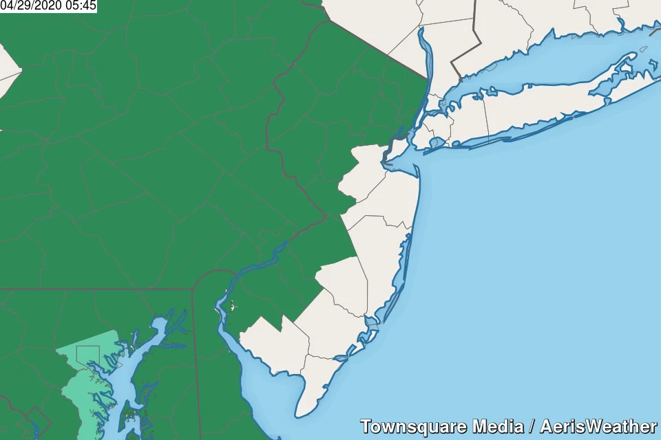
In fact, the National Weather Service has already issued a Flood Watch for northern and western New Jersey:
—2 p.m. Thursday to 2 p.m. Friday... NW Burlington, Camden, Gloucester, Hunterdon, Mercer, Morris, Salem, Somerset, Sussex, and Warren counties.
—8 p.m. Thursday to Noon Friday... Bergen, Essex, Hudson, Passaic, and Union counties.
Remember that flash flooding isn't always dramatic and biblical — it usually manifests as big puddles due to overrun or blocked storm drains. You do not want to drive or walk through any of those big puddles.
On the backside of that storm system Friday, it's going to be showery and cloudy. There's a chance we see some late-day peeks of sunshine. The air mass behind the front really won't be that cool, so we should see temperatures in the 60s Friday afternoon.
There is good news for the first weekend of May, with another welcome warmup on the way! Not a perfect forecast though.
One thing to watch is the chance for scattered showers hanging around through Saturday morning. Then, skies will clear to (at least) partial sunshine as high temperatures reach about 65 to 70 degrees.
Sunday gets even warmer, around 70 to 75 degrees. However, skies will turn mostly cloudy. And we'll eventually see a chance for rain — as early as Sunday late afternoon, as late as early Monday morning. (It all depends on which model you believe at this point, 4-5 days away.)
The long-range forecast shows another sustained cooldown by the middle of next week, which will last through the middle of May. Of justcourse. This emphasizing the fact that we need to appreciate and soak in every pleasant weather day we get!
More From 92.7 WOBM