NJ weather: Nice warm 70s Tuesday, but stormy changes are ahead
The Bottom Line
Flowers are blooming. Birds are chirping. Kids are playing outside. Isn't spring weather wonderful? (Except for the pollen, of course.)
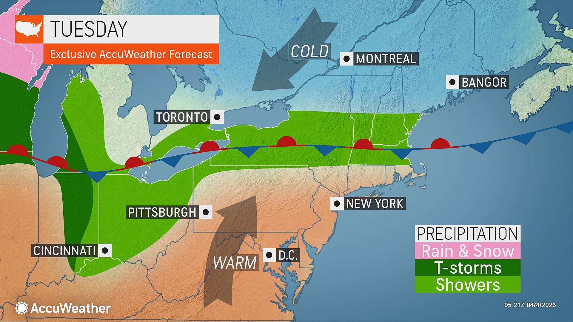
If you liked Monday's warm, bright, dry weather, Tuesday gets even better. A frontal boundary is stalled to the north, keeping New Jersey on the warm side for another day.
However, on Wednesday, it will drift south as a "backdoor" cold front, primarily impacting northeastern New Jersey with cooler, drizzly weather. It will look like a very different weather day, although most of it will stay completely dry.
Thursday carries a "yellow" alert icon on the 5 Day Forecast, with another concern for thunderstorms. The atmosphere is going to cook, with the possibility of 80+ degrees on the table Thursday.
Cooler, drier weather will prevail through the Easter holiday weekend.

Tuesday
Already, Tuesday morning is almost 20 degrees warmer than Monday morning. With 40s in many spots, it is probably still cool enough to reach for a jacket. But you will not want it this afternoon.
High temperatures on Tuesday will reach into the lower 70s across most of the state. The big exception will likely be the Jersey Shore, potentially stuck in the 50s or 60s (if you're lucky).
This is unseasonably warm for early April, about 15 degrees above normal highs (in the upper 50s).
The morning hours look bright and sunny Tuesday. And then fair weather clouds will dot the sky through the afternoon. Winds should stay light. Weather should remain dry during the daytime hours.
Tuesday evening, clouds will start to thicken up. And we could see spotty light drizzle around — especially in northern and coastal New Jersey. Low temperatures will only dip into the lower 50s. Once again, really not that cold.
Wednesday
A very different weather day. Although don't go canceling your plans, as most of Wednesday will remain dry.
We will see lots of clouds overhead Wednesday — call it mostly cloudy to overcast. And a few rain showers are possible, primarily in the late-day time frame. (After 4 p.m. or so.)
High temperatures are tricky, with a backdoor cold front draped over the state. I think it's safe to say that most NJ locales will end up in the 60s. But to the north and east, only mid 50s. To the south and west, probably lower 70s.
Thursday
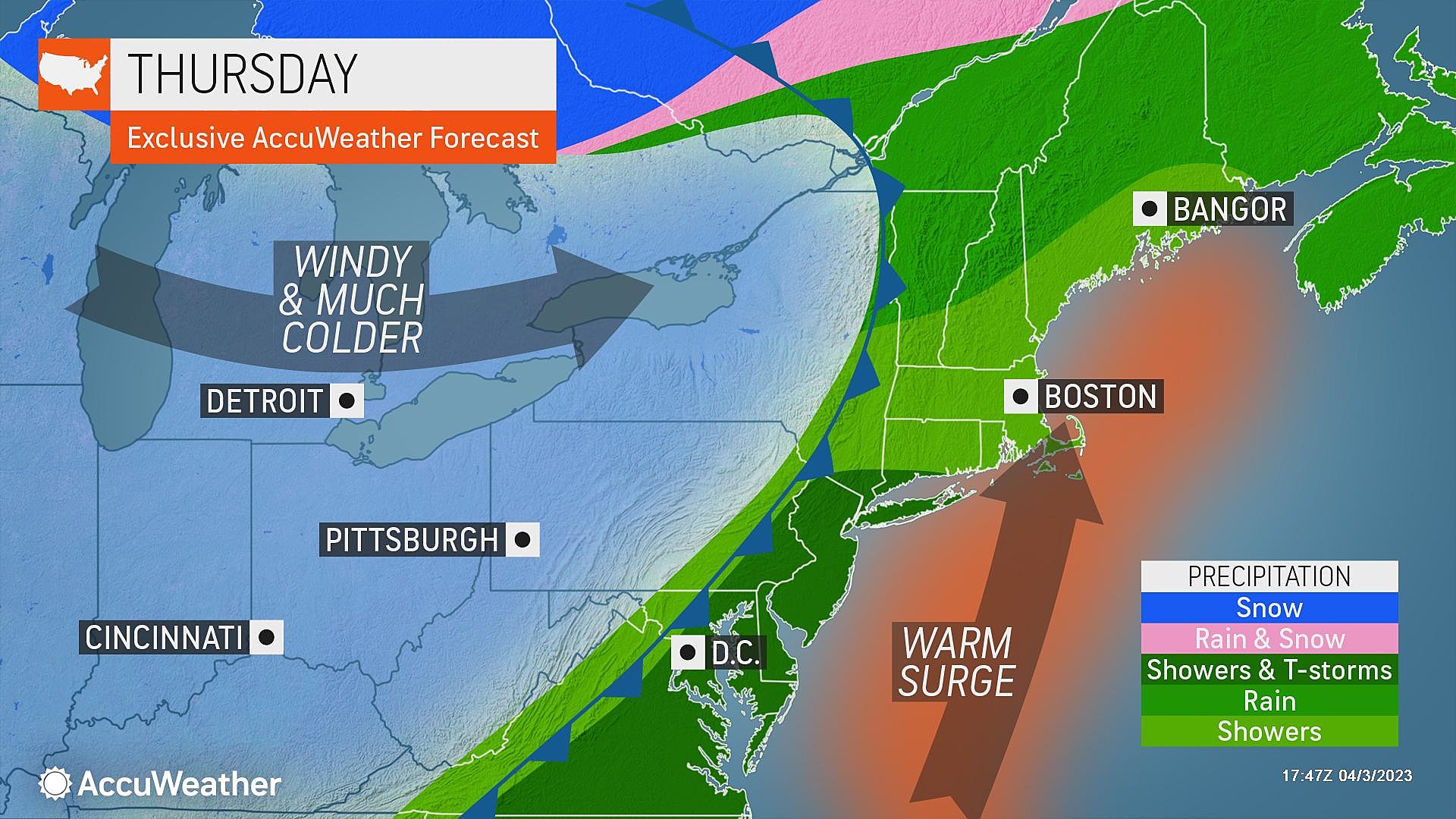
Thursday will be another interesting weather day. An active weather day. A "weather aware" day. Warm and stormy.
As a southwest "blast furnace" breeze kicks in, temperatures will return to widespread 70s by Thursday afternoon. We even have a legitimate shot at 80+ degrees somewhere in the state, for the first time this season.
However, all that warmth will cook the atmosphere. Setting the stage for another round of thunderstorms as a cold front arrives Thursday evening. Exact timing of potential rain, lightning, and wind is uncertain — but afternoon to early evening seems like a good guess for now.
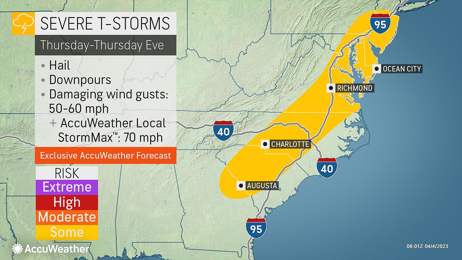
When I mention thunderstorms, I'm sure your mind harkened back to this past Saturday's round of terrifying weather. And yes, Thursday's storms could be strong or severe too. Gusty winds and localized downpours are the big concerns.
Not to get too technical, but I want to point out a few important differences here:
1.) Saturday afternoon was bright and sunny, destabilizing the atmosphere. Thursday is forecast to remain mostly cloudy, limiting sun breaks and limiting convective available potential energy.
2.) The low-level jet — a river of winds screaming less than a mile overhead — will be calmer on Thursday compared to Saturday. That is an important factor in wind shear and wind-driven damage.
3.) Possibly earlier timing. Thunderstorms love sunset — just past peak heating, a destabilizing atmosphere due to cooling temperatures. If storms arrive at 2 p.m. rather than 6 p.m., there is less opportunity for warmth, energy, and "perfect" instability.
To be clear, yes, we are ringing alarm bells for potentially dangerous storms on Thursday. But hopefully these mitigating factors will make them a bit less destructive and especially tornadic than Saturday.
This is obviously a serious weather situation that we'll be watching very closely in the coming hours and days. As always, we'll keep you updated on the latest forecast play-by-play.
Friday
Behind the cold front, drier, cooler, and calmer conditions should prevail on Friday.
I can't rule out showers lingering into the morning hours. And I think skies will be very slow to clear.
So Friday will be mostly cloudy, and breezy at times. High temperatures will end up in the upper 50s to around 60. Right around normal for early April. Can't complain about that.
The Extended Forecast
The rest of the holiday weekend looks dry and pleasant. Expect mixed sunshine and cloud cover on Saturday, with highs in the 60s. And a sunnier Easter Sunday, again in the 60s.
Long-range models keep primarily quiet weather over New Jersey for next week, with above-normal temperatures. If everything goes according to plan, New Jersey's next chance of showers wouldn't arrive until midweek.
Dan Zarrow is Chief Meteorologist for Townsquare Media New Jersey. Follow him on Facebook or Twitter for the latest forecast and realtime weather updates.
2023 Beach Badge Prices For The Jersey Shore
New Jersey's Top 5 Weirdest Attractions
More From 92.7 WOBM