
Wet start to Friday for NJ, then a wonderfully warm weekend
It's time for another summer weekend, and the forecast will progress from rain to humidity to gorgeous sunshine.
Here are your weather headlines for Friday, July 7, 2017...
Wrapping Up the Rain
The past 24 hours have been fairly wet, with some locations in New Jersey receiving between a half-inch and an inch of rain. Enough to soak the ground and moisten roads, but nothing to write home about. (Meanwhile, this same storm system dumped over 8 inches of rain on Warwick, Maryland on Thursday, according to the National Weather Service.)
Your Friday is starting with steady rain, mainly to the north and west. A few showers and some fog are hanging over central and southern New Jersey.
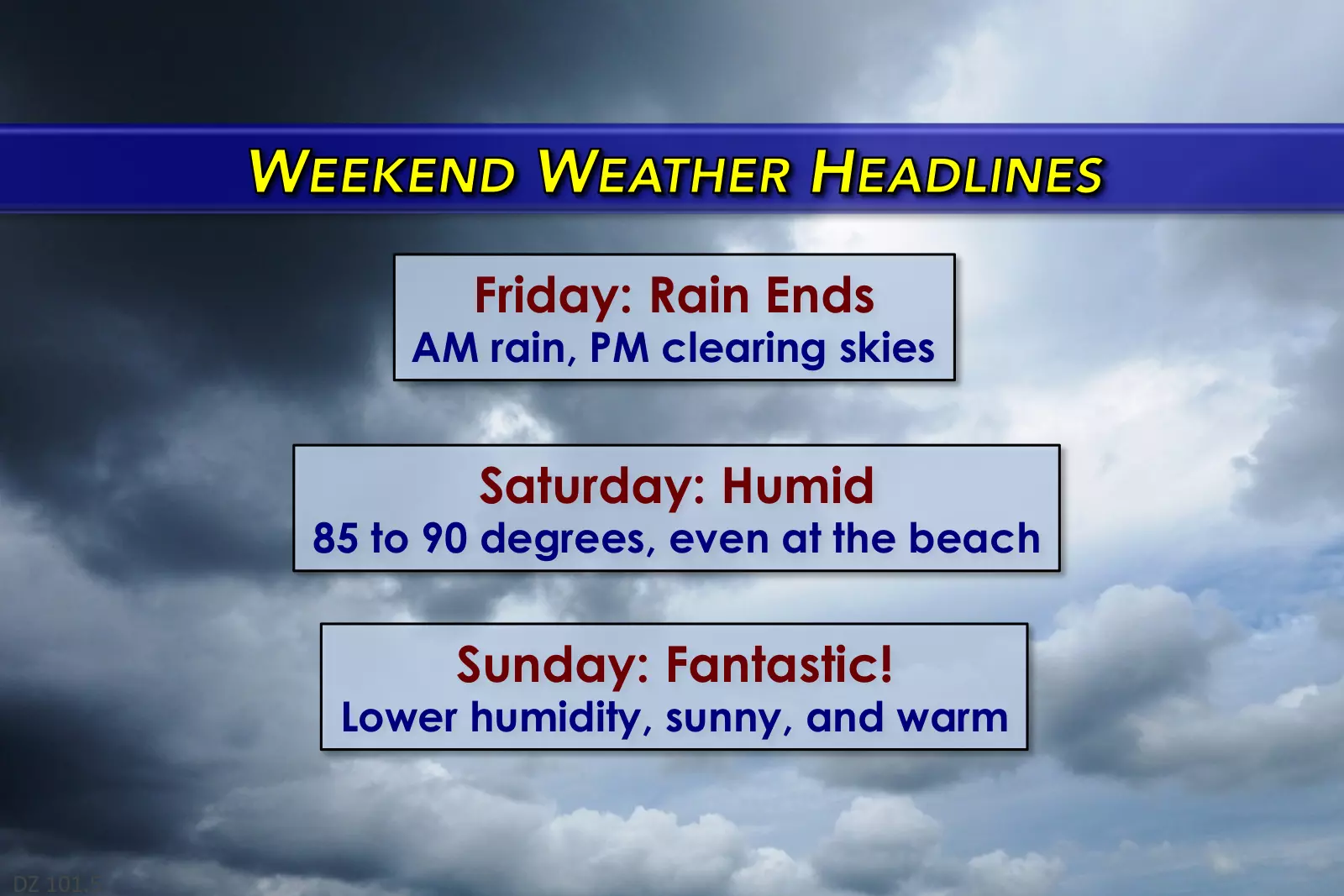
Rain should largely come to an end by the late morning to early afternoon hours, with skies clearing through Friday afternoon. I think we'll see solid breaks of sunshine by about 3 or 4 p.m.
Given the return of sunshine, Friday won't be as grey and cool as Thursday. High temperatures are forecast to peak in the lower 80s for most of the state. North Jersey and the Jersey Shore will probably top out in the upper 70s.
Steamy Start to the Weekend
Our atmosphere will remain humid Friday night, so conditions will remain muggy. Overnight low temps will only fall to around the 70 degree mark, under partly cloudy skies.
And Saturday looks very humid too. It's going to be a very warm, summery day — even the coast will be cooking, as the land breeze overtakes the sea breeze. High temperatures will be mostly in the mid to upper 80s. I wouldn't be surprised to see a few 90s sprinkled in Saturday too.
While a passing shower is possible at some point on Saturday, most of New Jersey should remain dry with partly sunny skies. Again, a decent (warm and humid) summer day.
Fantastic Finish to the Weekend
If you read my blog frequently, you know I'm not a fan of "horrendous" humidity and find summertime dry air days to be a real treat.
Sunday will be a real treat.
A weak front will push through New Jersey early Sunday morning. It's expected to be a dry frontal passage, so no rain is expected. And the air mass behind the front won't be that much cooler. It will be much drier though, leading to more comfortable conditions by Sunday mid-morning.
High temperatures on Sunday should reach the lower to mid 80s, with abundant sunshine. A gorgeous day all-around!
Looking Ahead to Next Week
Monday looks great too, with highs bumping into the mid 80s and continuing low humidity. Things will heat up on Tuesday and Wednesday, with thermometers potentially warming to 90 degrees for at least part of the state. Our next big chance for rain looks to come Wednesday night into Thursday.
Tropical Depression 4
Still out there, still far away from the United States, and still not expected to strengthen into a named storm within the next 3 days.
Still watching. We'll keep you updated, especially if the storm may pose a weather or wave threat for the Garden State.
More From 92.7 WOBM


