Dangerous heat and humidity continue this week across New Jersey. Resistance is futile. Although a series of cold fronts will drive in more comfortable weather.
Back in the "danger zone" across NJ Friday, with high temps 90 to 95, a heat index flirting with triple digits, and gusty, super-soaker thunderstorms likely.
A Heat Advisory is in effect for most of interior New Jersey from 11 a.m. Thursday until 8 p.m. Friday, cautioning of sultry, potentially dangerous conditions.
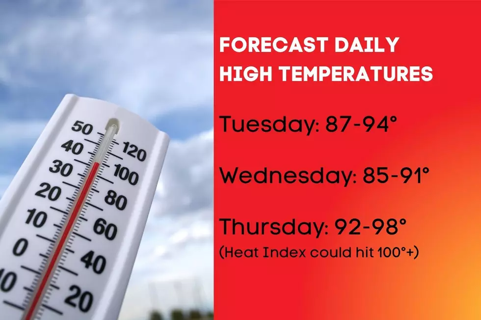
Tuesday will be hot and humid again, about 10 to 15 degrees warmer than Monday. An isolated shower is possible as a weak cold front pushes through New Jersey.
The first week of August brings two headlines in the forecast: building heat and humidity, and some wet weather that could alleviate spiraling drought concerns.
Let's talk about how drought is measured and monitored, which parts of New Jersey are most vulnerable, and how long the abnormally dry streak has been going on?