
Nor’easter winds down – beware the flash freeze
Whether you saw snow, rain, sleet, freezing rain, or a wintry mix, our sloppy Tuesday will be followed by an icy Tuesday night.
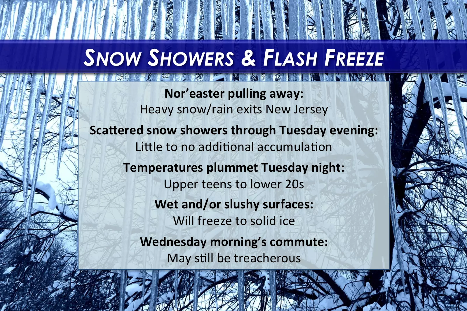
As you probably know, Tuesday's powerful coastal storm didn't exactly perform according to forecast. The nor'easter still dropped upwards of 17.5 inches of snow and 3.47 inches of rain over the Garden State (in Sussex and Woodbine, respectively). A 65 mph wind gust was registered at Seaside Heights.
As we look toward the immediate future, colder air will flow into New Jersey through Tuesday night. As temperatures drop rapidly below the freezing mark, all those puddles, water droplets, and slush are subject to a “flash freeze” overnight. This could lead to incredibly slick and hazardous road conditions. This will be true even for locations that saw mostly rain from this winter storm.
Overall, we will characterize Tuesday night as wintry and cold, as temperatures fall into the upper teens to lower 20s. Regular wind gusts over 20 mph will not only produce frigid wind chills, but also reduce visibility due to blowing snow. Add a glaze of ice on just about every surface, and you have the perfect excuse to exercise extreme caution through Wednesday morning.
Our longer-range weather forecast unfortunately does not include a sustained warmup, even with the first day of Spring less than a week away. Areas that experienced snow and sleet accumulation will probably remain snowy and icy for the foreseeable future.
More From 92.7 WOBM


